The concept of GeoResonance Remote Sensing can be broken down into four key steps:
The workflow of a GeoResonance Remote Sensing survey is tailored to meet the specific requirements of each client, but in general, it involves the following phases:
CAPABILITY | DESCRIPTION | APPLICATION |
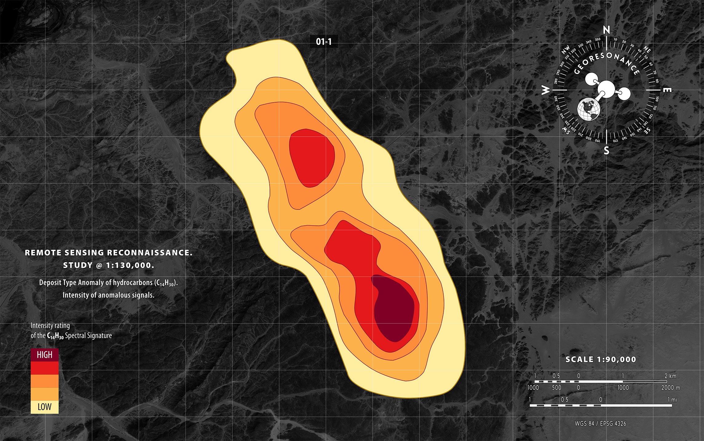
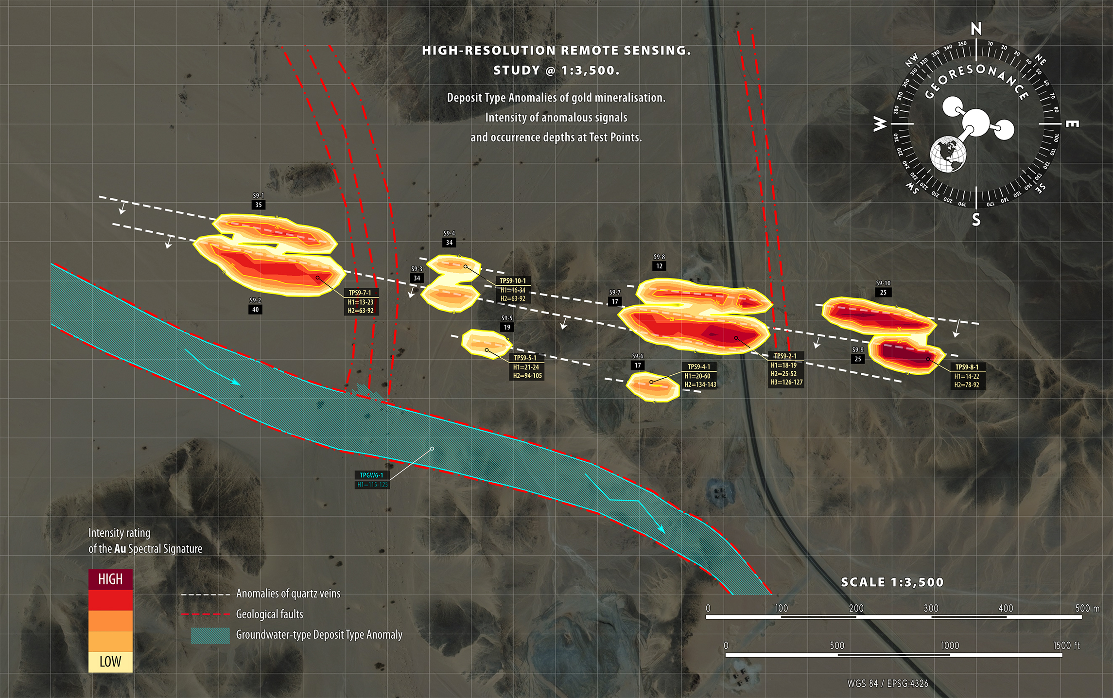
| Survey of any terrain | Remote Sensing surveys can be conducted for various types of environments, including onshore or offshore, deserts, forests, and mountainous areas. The size of a study area can range from a minimum of 25 km2 to virtually unlimited. | |
| Direct identification of substances | Characteristic Spectral Signatures of the targeted substances are studied for reliable and unambiguous detection. | |
| High sensitivity | Targeted subsurface substances with concentrations of 1-1.5 g/t can be detected by GeoResonance Remote Sensing. | |
| Sensing depths down to 5,500 m (18,000 ft) | Accumulations of subsurface substances can be reliably identified at 5,500 m (18,000 ft) depths for hydrocarbons, 1,500 m (5,000 ft) depths for minerals, and 3,000 m (10,000 ft) for groundwater. | |
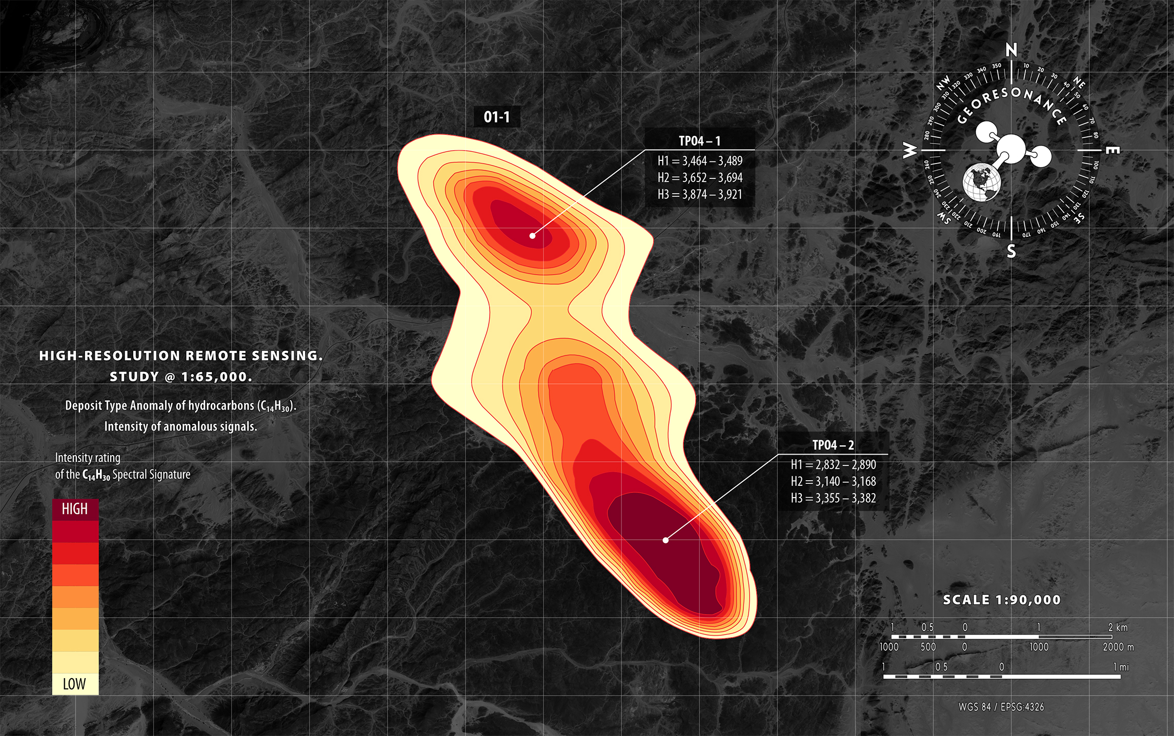
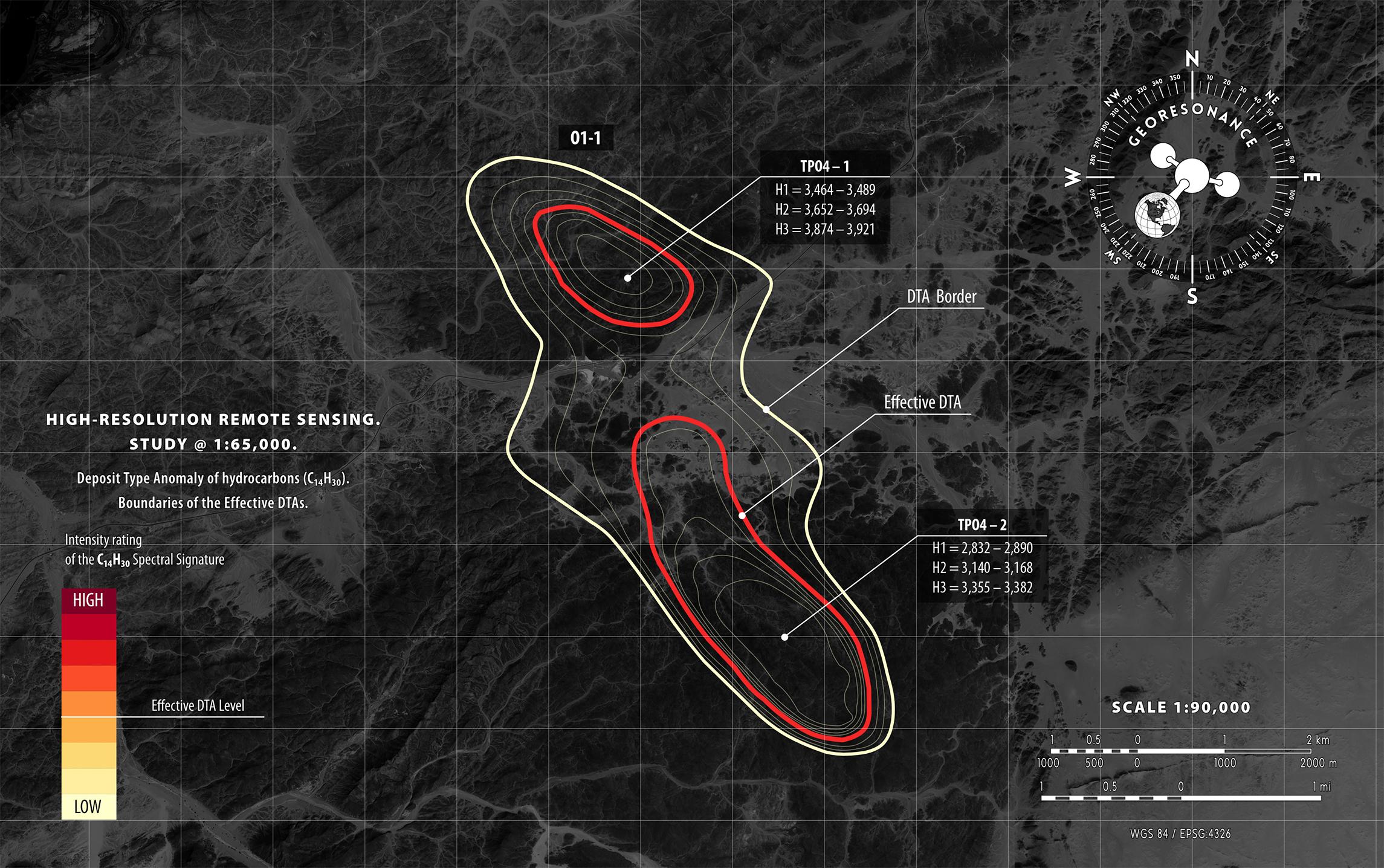
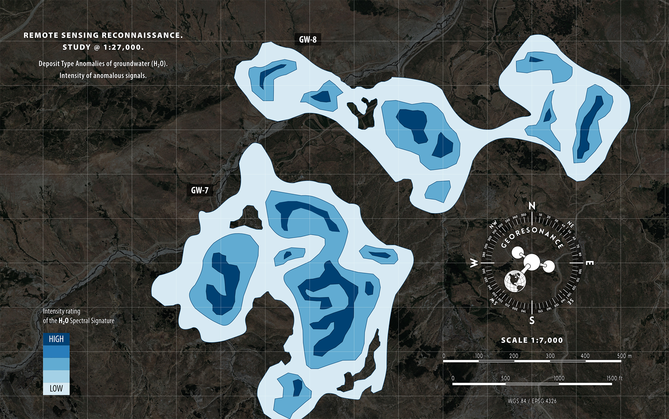
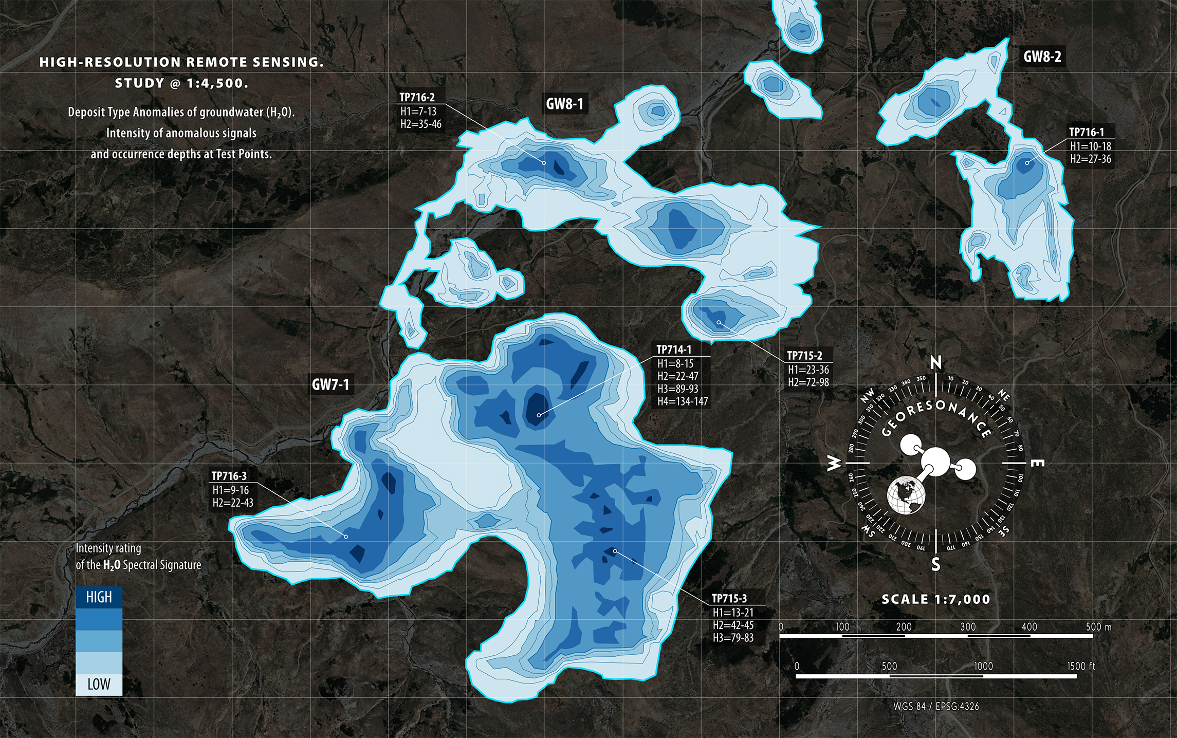
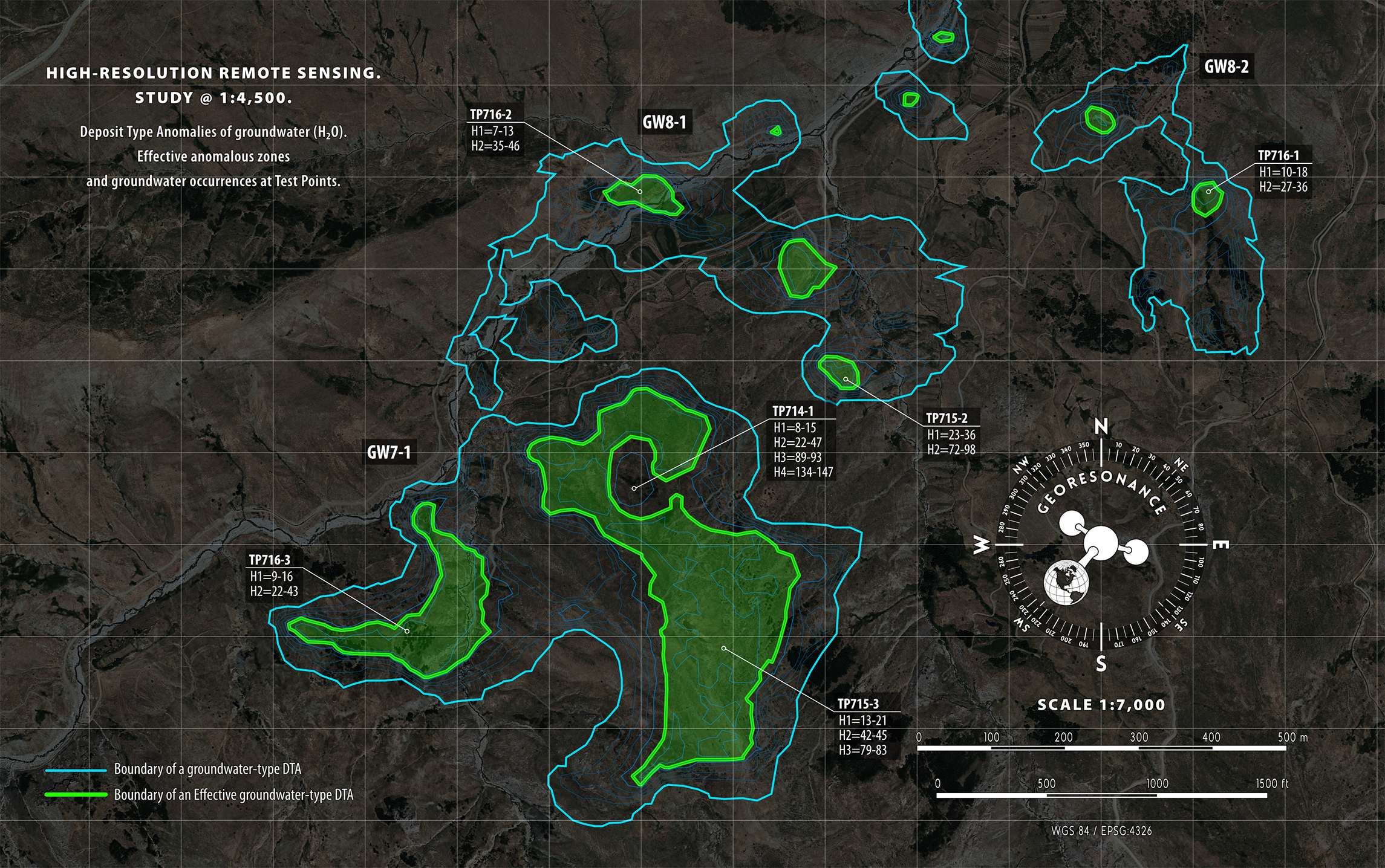
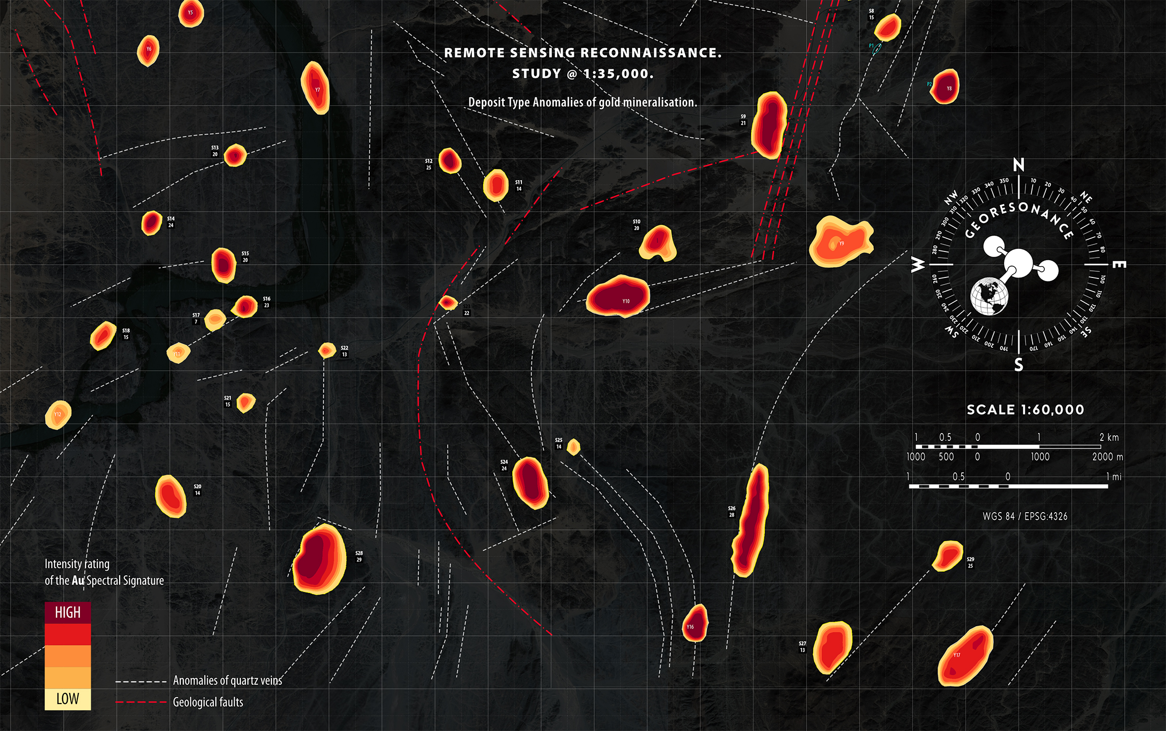
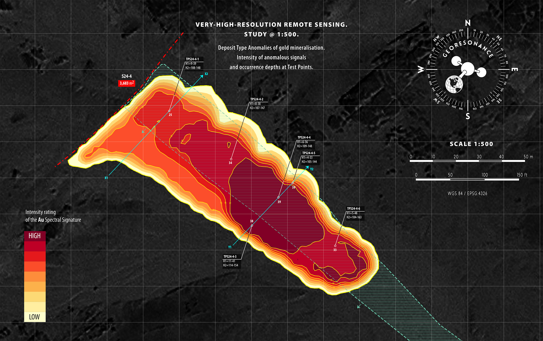
| Identification of Deposit Type Anomalies (DTA) | A DTA is a representation of the targeted subsurface deposits projected onto the surface of the earth. GeoResonance reports the contours of anomalous zones, their size, and the distribution of the intensity of anomalous signals. | |
| Identification of Effective Deposit Type Anomalies | An Effective Anomaly refers to an area inside the identified DTA with the highest intensity of anomalous signals. Typically, Effective Anomalies are attributed to the highest volumes of the targeted substance. | |
| Evaluation of occurrence depths | Occurrence depths are estimated at Test Points, which are selected inside DTAs, in the areas of high intensity of anomalous signals. True Vertical Depths to the top and bottom of each horizon are reported. | |
| Estimation of reservoir pressure | Reservoir pressure inside identified hydrocarbon and groundwater anomalies is reported on GeoResonance isoline maps. | |
| Evaluation of oil-water and gas-water contacts | Oil-water and gas-water contacts are evaluated at Test Points and reported for each identified hydrocarbon anomaly. | |
| Identification of the direction of migration | The direction of migration of subsurface fluids in aquifers is studied and reported by GeoResonance. | |
| Modelling of deposit cross-sections | Cross-sections of identified anomalous zones are constructed based on the depths measurements at Test Points. | |
| Identification of decompression zones and geological faults | The location and orientation of identified geological faults and decompression zones are plotted on a GeoResonance topographic map of the study area. | |
| Geothermal investigation | Surface temperature anomalies are mapped through thermal infrared Remote Sensing of the survey area. | |
| High accuracy | The accuracy depends on the resolution of analogue multispectral images that are studied during a survey. Depth estimation errors are within ± 1.5 - 5.0 %. | |
| Recommendations for further exploration and drilling | Valuable recommendations for further exploration are provided by GeoResonance's report through identification of the most promising areas for sampling and drilling. | |
| Survey results can be reported on maps of any scale | Survey results can be reported on maps with varying scales, ranging from 1:500 to 1:1,000 for large scale maps, and as low as 1:250,000 for smaller scale maps. | |
| Fast execution | The duration of the survey depends on the size of the study area and the number of targeted commodities. A Remote Sensing survey covering 1,000 km2 could take between 8 and 13 weeks to complete. |
Unambiguous identification of a substance can only be achieved through the reliable identification of its atomic nucleus. In modern science, spectroscopy techniques are used to study atomic structures. Spectroscopy measures radiation intensity as a function of wavelength, providing unique spectral fingerprints for atoms and molecules. These fingerprints can be used to detect, identify, and quantify information about the atoms and molecules present in a sample, allowing for unambiguous identification of a substance.
The GeoResonance approach to identifying subsurface deposits during an On-Site Survey can be broken down into three steps:
The workflow of a GeoResonance On-Site Survey depends on the scope of client's requirements. In general, a survey goes through the following phases:
CAPABILITY | DESCRIPTION | APPLICATION |
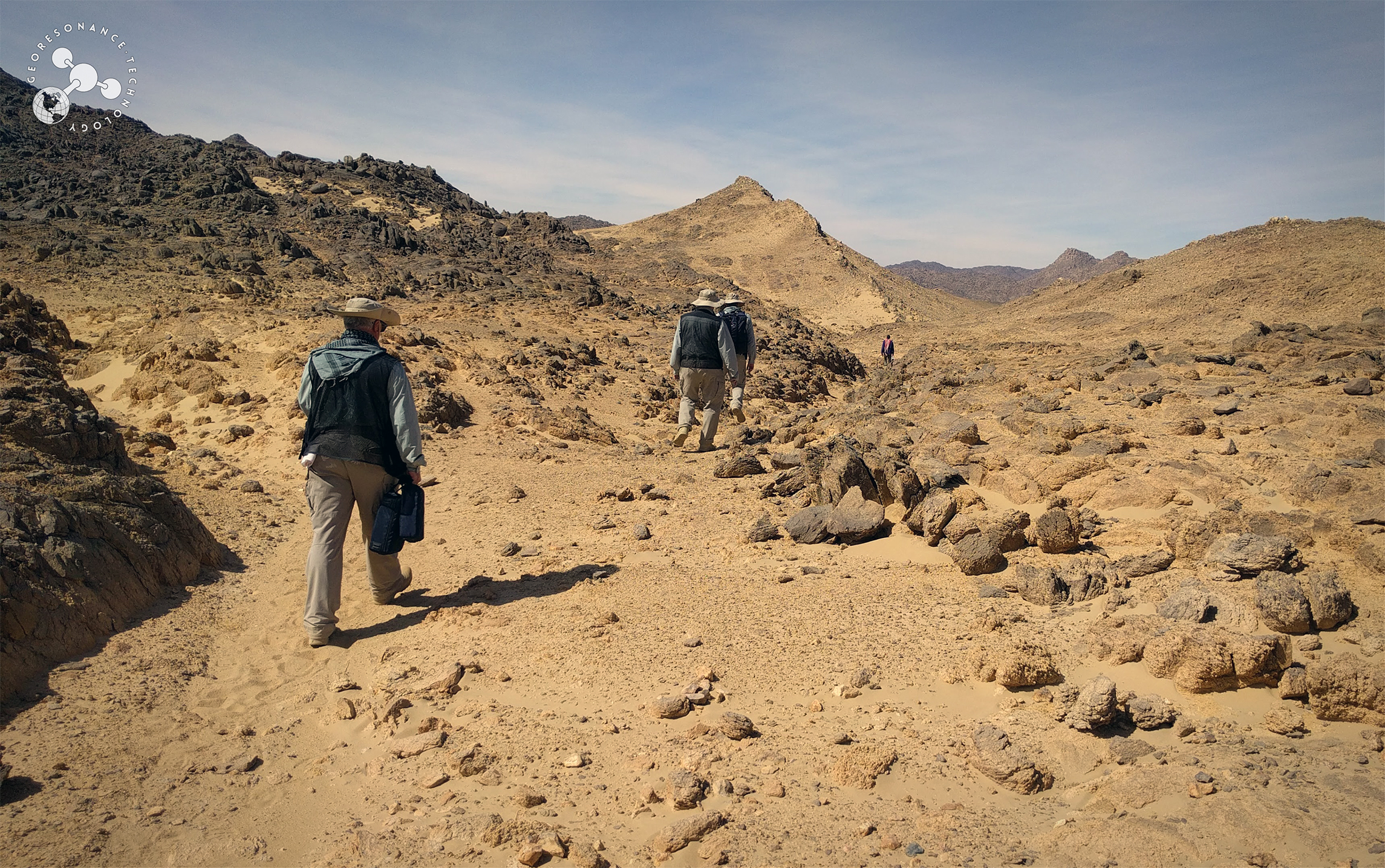
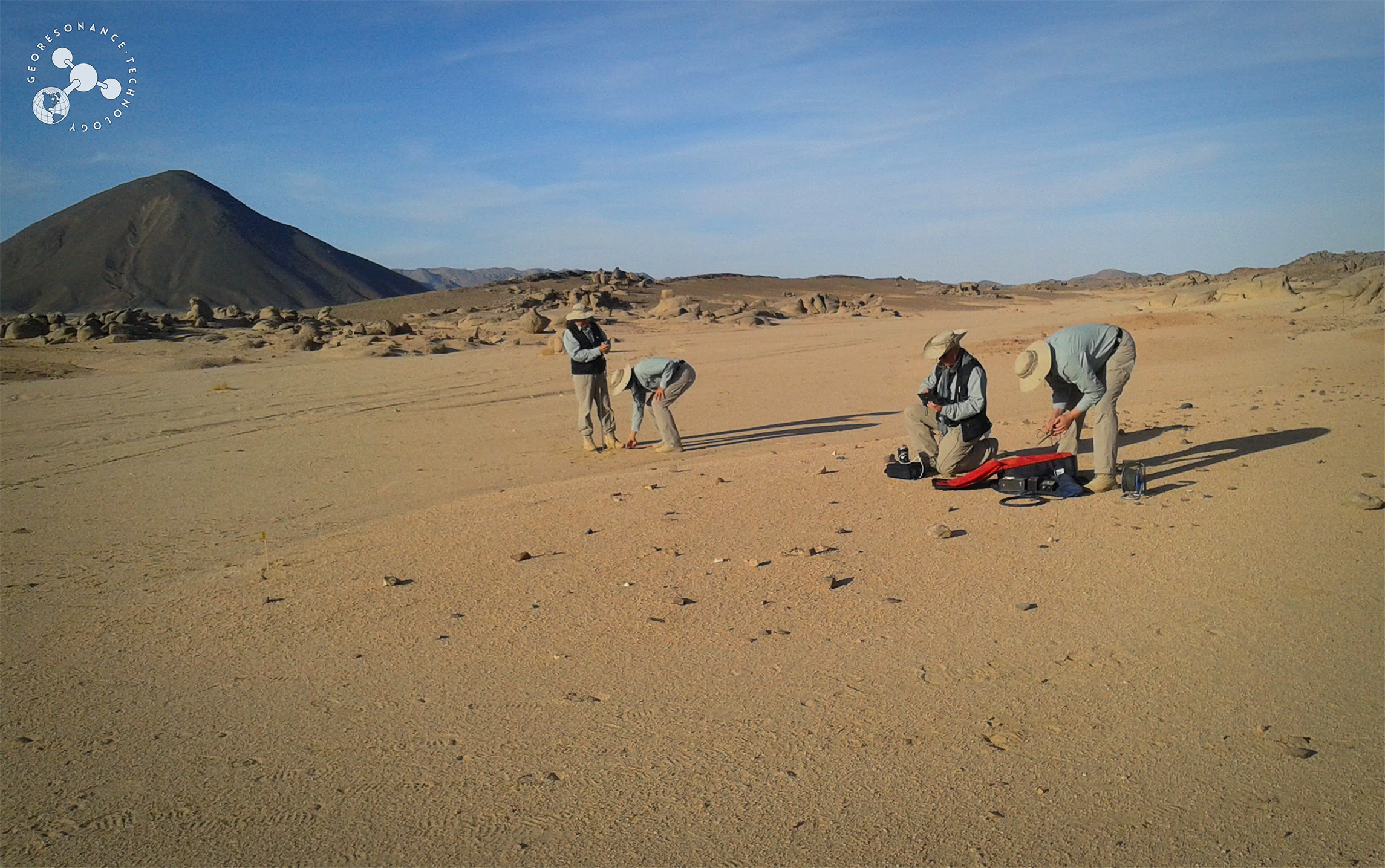
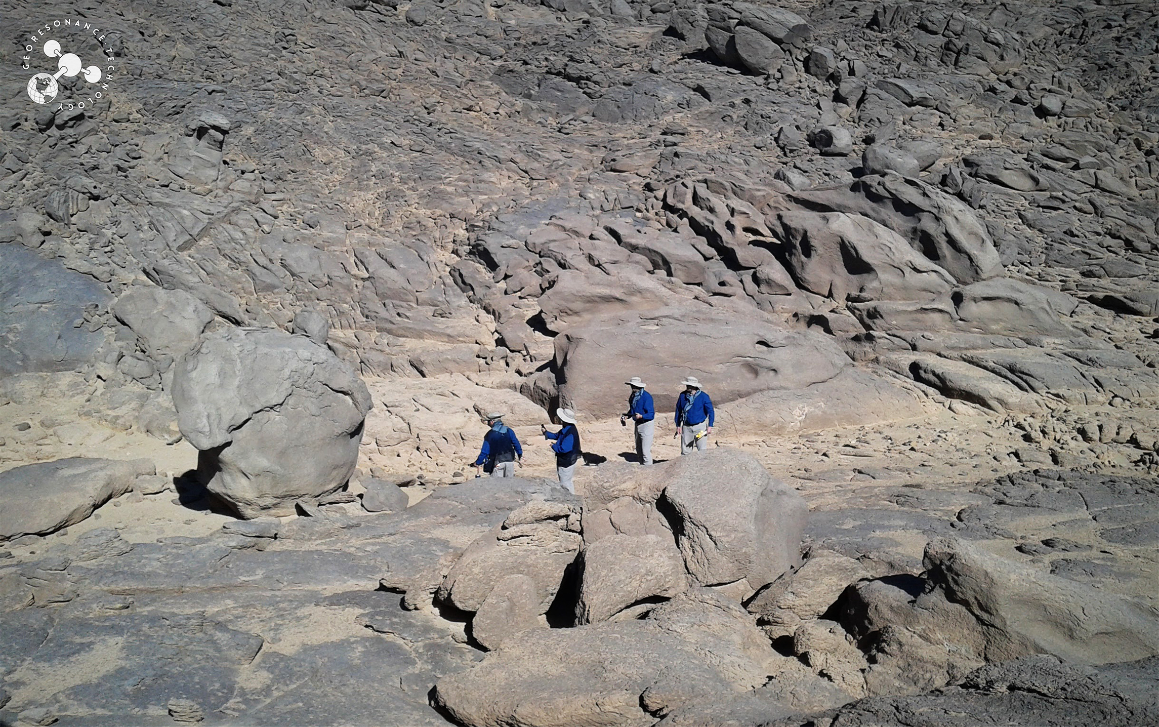
| Ease of deployment in all terrain types | The GeoResonance On-Site Survey Team is mobile, as the combined weight of the equipment is less than 45 kg. Surveys can be undertaken onshore or offshore, in deserts, forests, mountains. | |
| Direct identification of substances | Mobile GeoResonance equipment detects characteristic Spectral Signatures of targeted substances to ensure reliable and unambiguous identification. | |
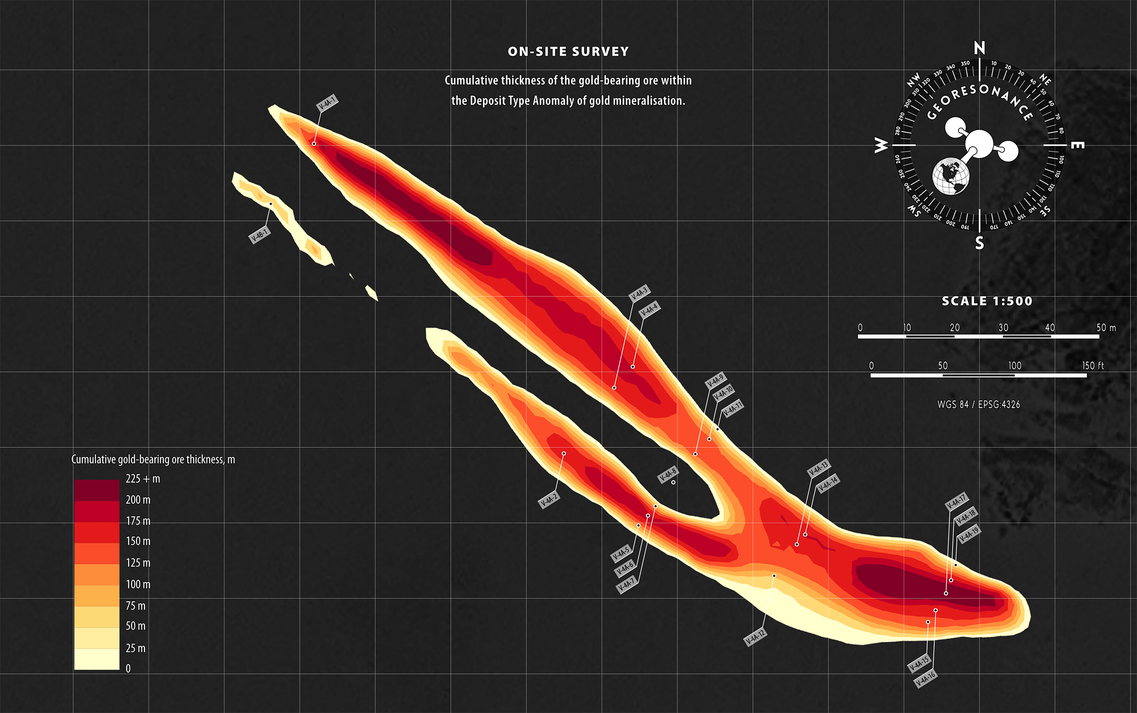
| High sensitivity | Targeted subsurface substances with concentrations of 1 - 1.5 g/t can be detected by the GeoResonance On-Site Survey equipment. | |
| Sensing depths down to 5,500 m (18,000 ft) | Accumulations of subsurface substances can be reliably identified at 5,500 m (18,000 ft) depths for hydrocarbons, 1,500 m (5,000 ft) depths for minerals, and 3,000 m (10,000 ft) for groundwater. | |
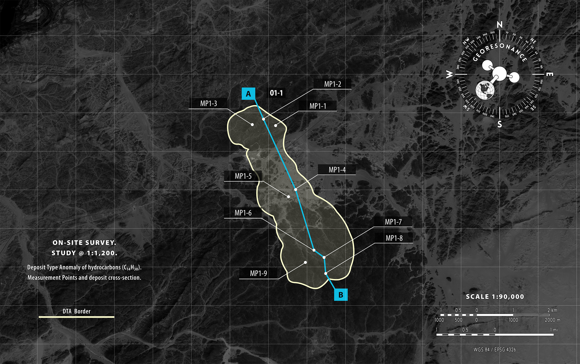
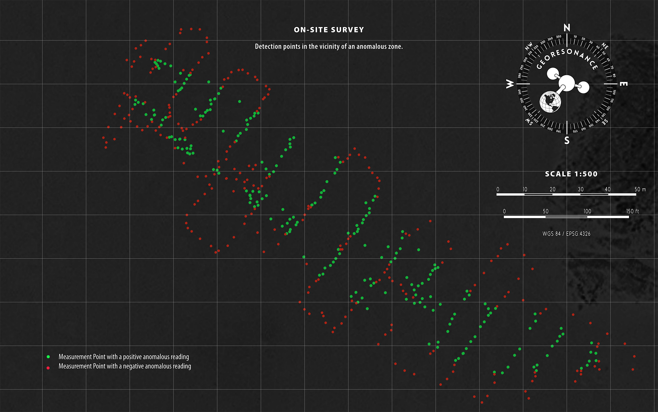
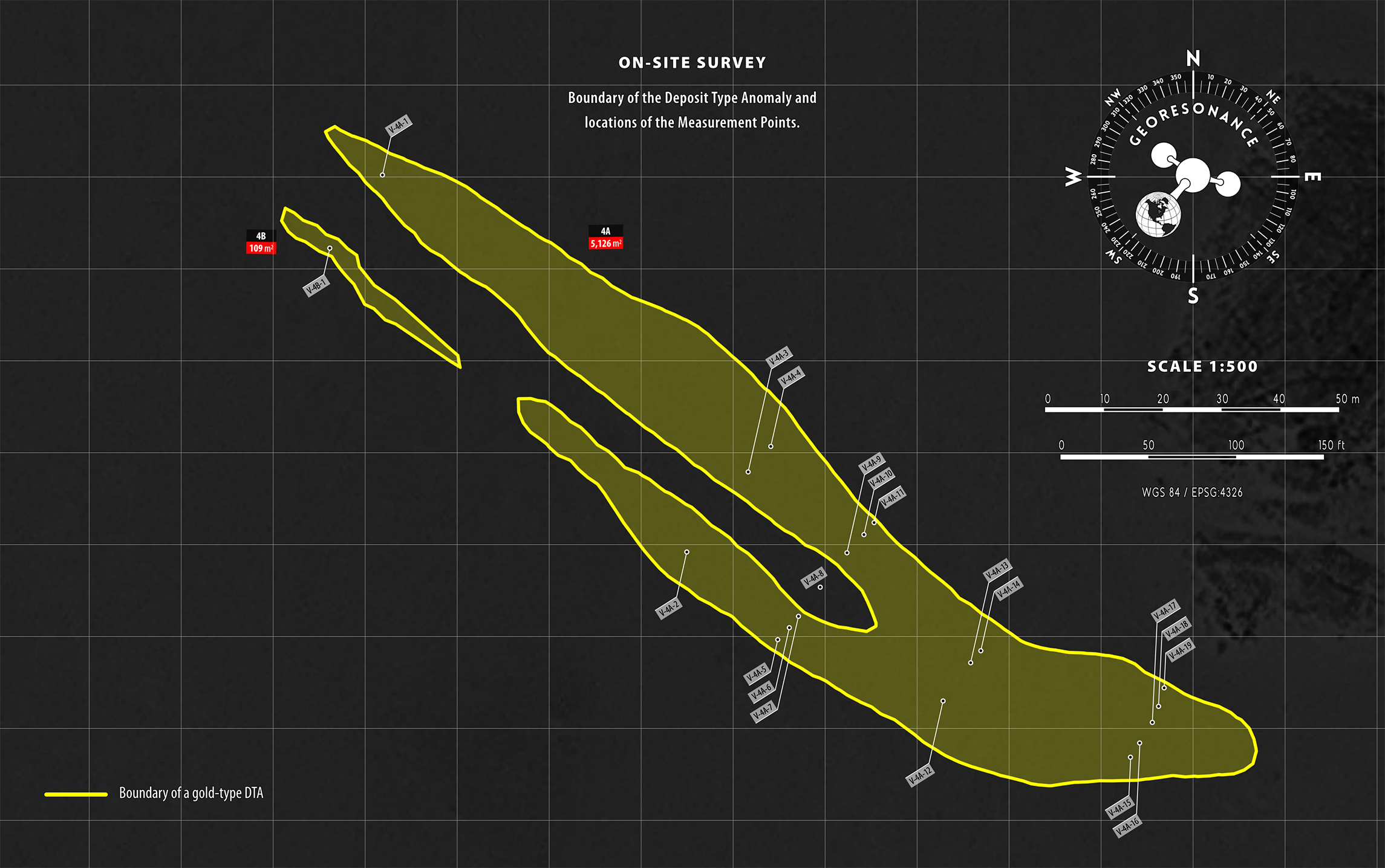
| Identification of Deposit Type Anomalies (DTA) | A DTA is a representation of the targeted subsurface deposits projected onto the surface of the earth. GeoResonance reports the contours of anomalous zones, their size, and the distribution of the intensity of anomalous signals. | |
| Identification of Effective Deposit Type Anomalies | An Effective Anomaly refers to an area inside the identified DTA with the highest intensity of anomalous signals. Typically, Effective Anomalies are attributed to the highest volumes of the targeted substance. | |
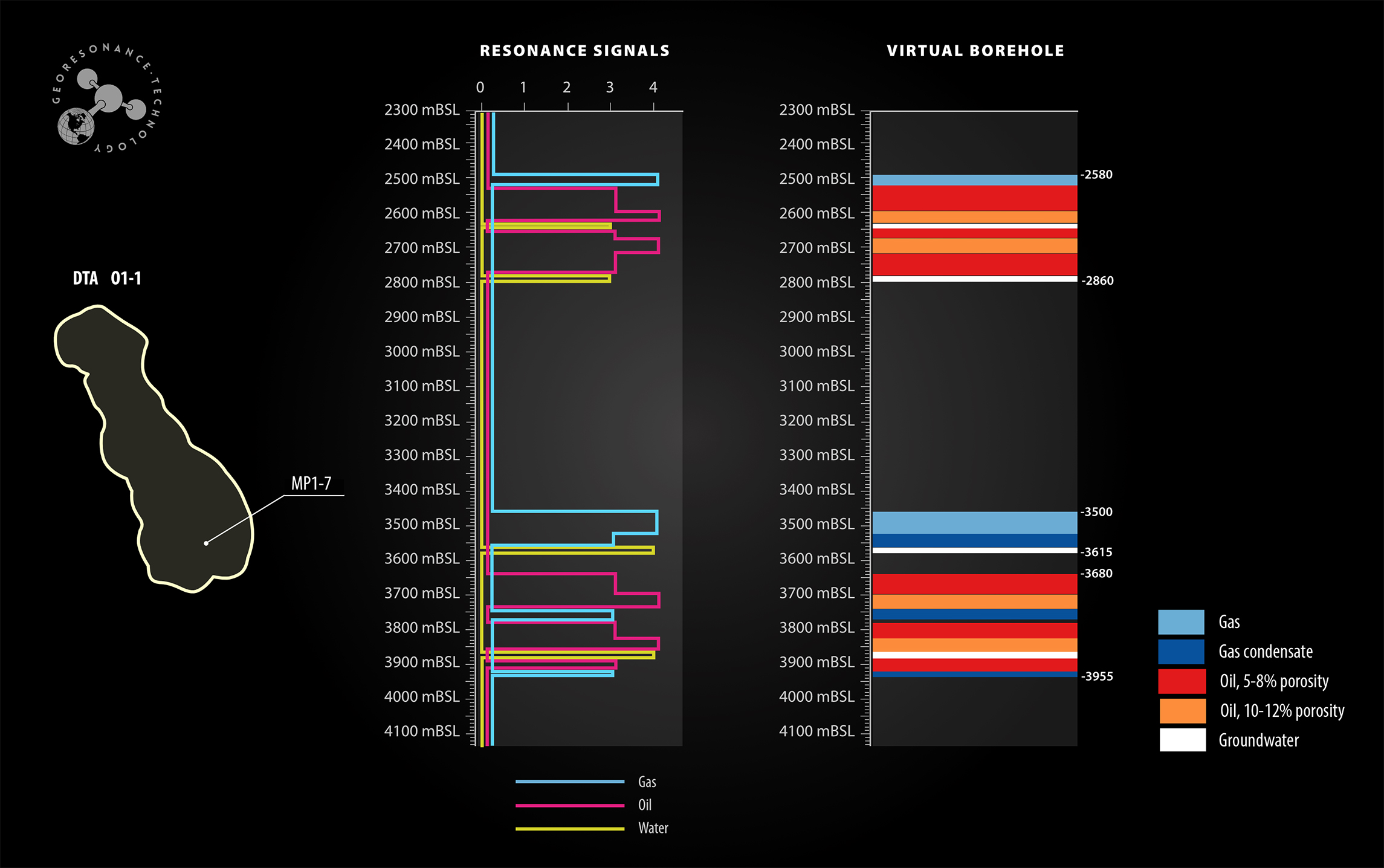
| Measurement of occurrence depths | Occurrence depths are determined at Measurement Points. True Vertical Depths to the top and bottom of each horizon are reported. Depth estimation errors are within ± 0.1 - 3%. | |
| Determination of reservoir rock types | Based on the Spectral Signatures of indigenous reference rock samples, the presence of reference reservoir rock types can be identified at Measurement Points. | |
| Measurement of reservoir pressure | Reservoir pressure inside identified hydrocarbon and groundwater anomalies is reported on GeoResonance isoline maps. | |
| Measurement of reservoir temperature | Reservoir temperature is determined at Measurement Points inside the identified groundwater and geothermal anomalies. | |
| Determination of oil-water and gas-water contacts | GeoResonance determines the presence and occurrence intervals of aquifers by studying Spectral Signatures of groundwater at Measurement Points. This allows for the estimation of water contact depths within the hydrocarbon reservoir. True Vertical Depths to the top and bottom of each aquifer are reported. | |
| Virtual Boreholes | Occurrences of targeted substances and major litholigic units are determined at Measurement Points. | |
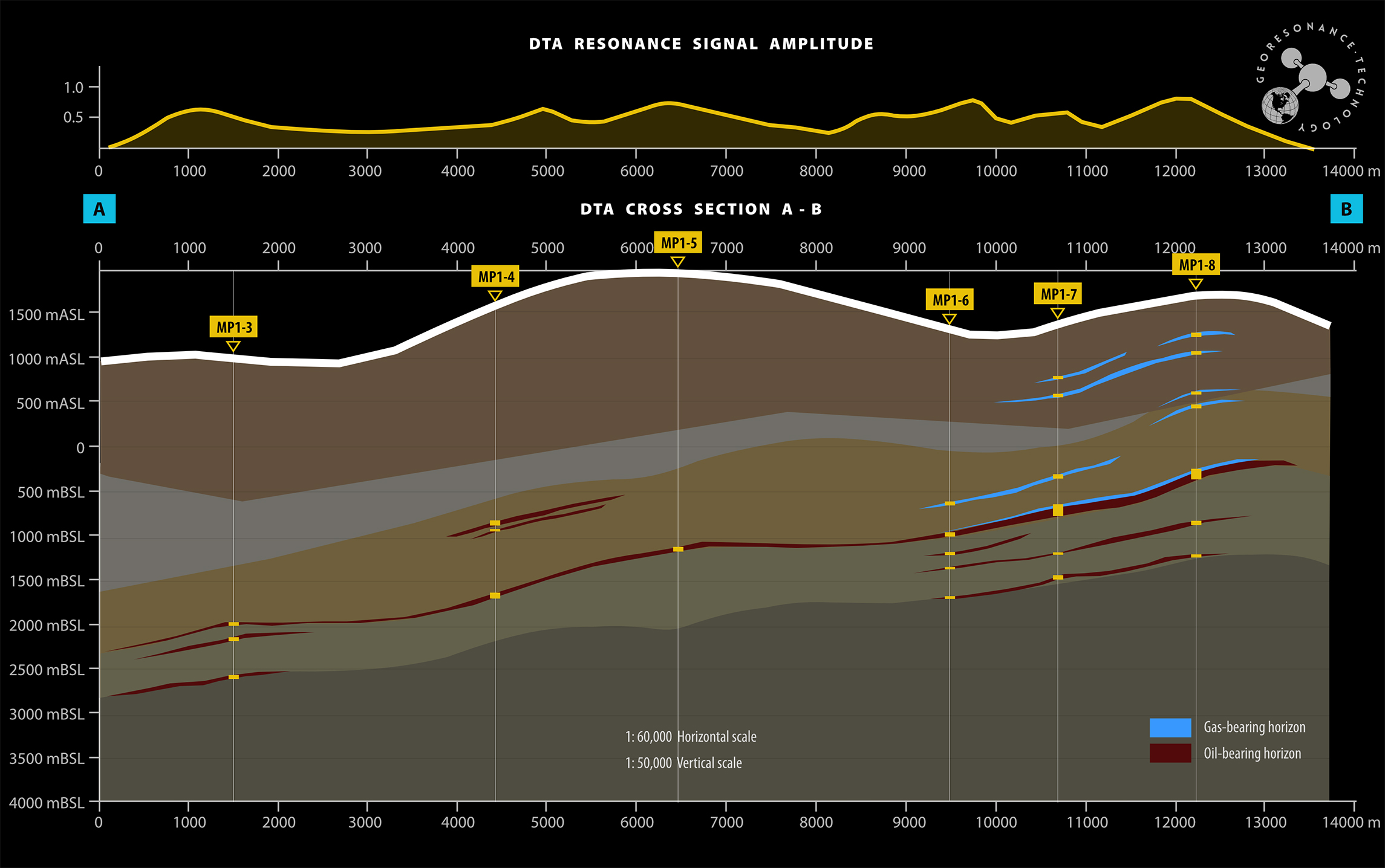
| Modelling of deposit cross-sections | Cross-sections of the identified anomalous zones are constructed based on depth measurements taken at Measurement Points. | |
| Identification of decompression zones and geological faults | The location and orientation of identified geological faults and decompression zones are plotted on a GeoResonance topographic map of the study area. | |
| Direction of migration | The directions of migration of subsurface fluids in aquifers is studied and reported by GeoResonance. | |
| Estimation of in-place resources | The data collected at Measurement Points is used to model subsurface deposits and estimate inferred Petroleum-Initial-In-Place, Mineral Resources, and groundwater resources. | |
| Selection of locations for drilling of exploration wells | Locations for exploratory wells are suggested based on the highest intensity of anomalous signals and volumes of the targeted substance to ensure successful testing and production of the deposit. | |
| High accuracy | Depth estimation errors are within ± 0.1 - 3%. | |
| Recommendations for further exploration | The GeoResonance report provides valuable recommendations for subsequent exploration stages by identifying the most promising areas for sampling and drilling. | |
| Survey results can be reported on maps of any scale | Survey results can be reported on maps with varying scales, ranging from 1:500 to 1:1,000 for large scale maps, and as low as 1:250,000 for smaller scale maps. | |
| Fast execution | The duration of the survey depends on the size of the study area, the number of targeted commodities, and the number of measurements required to delineate a deposit. On-Site Survey of 1,000 km2 can take between 8 and 12 weeks. |